

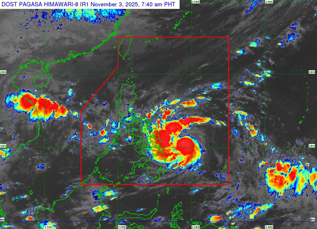
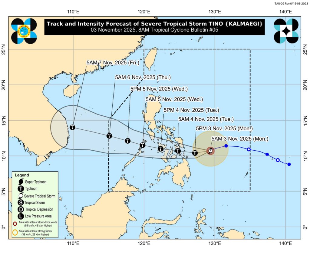
Severe Tropical Storm Tino — internationally known as Kalmaegi — intensified overnight as it continued a west-southwestward track toward the central Philippines, according to the latest advisory issued by the national weather bureau at 8:00 a.m. Tuesday.
At 7:00 a.m., the center of Tino was located about 360 kilometers east of Guiuan, Eastern Samar, carrying maximum sustained winds of 110 km/h near the center and gusts reaching 135 km/h. Forecasters warn the system is nearing typhoon category and could intensify further within the next 12 hours.
The storm is moving at 25 km/h, with strong to storm-force winds extending up to 300 kilometers from its center.
Wind Signals Up in Multiple Regions
The storm’s approach has prompted escalating Tropical Cyclone Wind Signals (TCWS), covering wide portions of the Visayas and Northern Mindanao.
TCWS No. 3 — indicating storm-force winds and posing moderate to significant threats — is now raised over:
- Portions of Eastern Samar, including Guiuan and Mercedes
- Dinagat Islands, and Siargao and Bucas Grande Islands
TCWS No. 2 — warning of gale-force conditions — includes:
- Central and southern areas of Eastern Samar and Samar
- Leyte, Biliran, Southern Leyte, Bohol
- Parts of Cebu, including Metro Cebu and outlying islands
- Portions of Negros Occidental
- Parts of Surigao del Norte, Surigao del Sur, and Agusan del Norte
TCWS No. 1 covers communities as far north as Sorsogon, Albay, and Romblon, and extends across much of the Visayas and northern parts of Mindanao like Misamis Oriental and Bukidnon.
Authorities say the highest possible signal could reach No. 4 as the cyclone continues to strengthen.
Rain, Storm Surge, and Dangerous Seas Expected
While the storm is still offshore, impacts are already being felt:
✅ Severe winds likely over areas under Signal No. 3
✅ Strong Northeast Monsoon surge enhancing gusts in Luzon
✅ Life-threatening storm surge over low-lying coastal zones
Storm surge exceeding 3 meters may affect:
- Sorsogon, Masbate, Romblon
- Mindoro provinces, Palawan
- Wide areas of Visayas
- Dinagat Islands, Surigao provinces
- Agusan del Norte, Misamis Oriental, Camiguin
Mariners are strongly advised to remain in port, as seas could reach up to 9 meters over eastern waters of Visayas and Mindanao. Coastal flooding and port closures are anticipated.
Weather agencies project Tino to:
- Make landfall late tonight or early Wednesday morning
— Possible points: Southern Eastern Samar, Leyte, Southern Leyte, or Dinagat Islands - Cross the Visayas and northern Palawan
- Re-emerge over the West Philippine Sea by Wednesday
Tino may reach peak intensity of 150–165 km/h winds during landfall. Rapid intensification remains a possibility — and super typhoon status cannot be ruled out.
Even areas outside its center and track cone may experience flooding, landslides, destructive winds, and coastal inundation.
Preparedness Urged
Disaster officials are advising communities in high-risk zones to prepare for evacuation and remain alert for local emergency directives.
Residents are urged to:
- Monitor updates from regional PAGASA offices
- Stay away from coastlines and flood-prone areas
- Secure homes and essential supplies
The next official bulletin is scheduled at 11:00 a.m. today.
Stay tuned for continuing coverage as Severe Tropical Storm Tino moves closer to the Philippines.