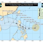


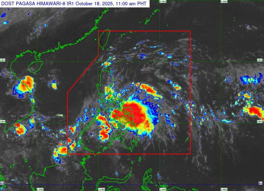
MANILA — Tropical Storm Ramil (international name Fengshen) has slightly intensified as it moves closer to the coastal waters of Northern Samar, the state weather bureau reported late Saturday morning.
As of 10 a.m., the center of Ramil was located off the coast of Palapag, Northern Samar, carrying maximum sustained winds of 75 kilometers per hour (kph) and gusts reaching up to 90 kph. The system is moving west-southwest at 20 kph, with strong to gale-force winds extending up to 400 kilometers from its center.
Signal Warnings Raised
Signal No. 2 is currently in effect over parts of Northern Samar, Catanduanes, Camarines Norte, and several areas in Bicol and Eastern Visayas, where gale-force winds may pose minor to moderate risks to life and property.
Signal No. 1 remains raised over a wide portion of Luzon, including Cagayan Valley, Central Luzon, and the rest of Bicol and Eastern Visayas, with possible minimal to minor wind impacts.
Heavy Rainfall Expected
According to PAGASA, Ramil will continue to bring heavy rains throughout the weekend.
- Up to 200 mm of rain is expected in Northern Samar, Sorsogon, and parts of Bicol.
- 50–100 mm of rainfall may affect Metro Manila, CALABARZON, and Central Luzon by Sunday.
Flooding and landslides remain possible, especially in mountainous and low-lying areas.
Possible Landfall
The storm is forecast to make landfall or pass close to Northern Samar by noon or early afternoon Saturday, then cross Catanduanes later in the day. It may move across mainland Bicol and the Polillo Islands before making another landfall in Aurora or northern Quezon by Sunday.
PAGASA added that Ramil could still strengthen into a severe tropical storm before making landfall.
Coastal and Sea Hazards
Residents in coastal areas of Isabela, Quezon, Aurora, and the Bicol Region are advised to remain alert for possible storm surges of up to two meters. Sea conditions in the eastern seaboards of Luzon and Visayas will remain rough to very rough, with waves reaching up to five meters.
Small boats and fishing vessels are strongly discouraged from sailing due to the hazardous sea conditions.
Public Advisory
PAGASA urged local governments and disaster officials to implement precautionary measures, especially in flood-prone and landslide-prone areas.
Tropical Storm Ramil is expected to exit the Philippine Area of Responsibility (PAR) by Monday morning after crossing Northern Luzon and moving toward the West Philippine Sea.
The next weather bulletin will be released at 2:00 p.m. today, PAGASA said.